📍Location
- Google Maps ↗
Tryon Creek State Natural Area: Start at Nature Center
PortlandOregon, OR
Stewardship Thursdays
- When
- Thursday, Nov 12, 2026 · 9:00 AM
- Where
- Tryon Creek State Natural Area: Start at Nature CenterPortlandMap
Website ↗
Add to calendar
About this event
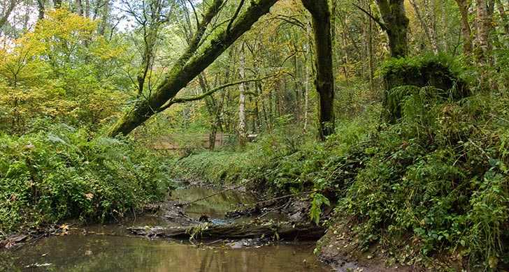
var templateData = ; var serverData = ; templateData,{"park_id":105,"hub_property_id":6,"park_name":"Ainsworth State Park","park_latitude":45,{"park_id":51,"hub_property_id":209,"park_name":"Alfred A. Loeb State Park","park_latitude":42,{"park_id":135,"hub_property_id":3,"park_name":"Arcadia Beach State Recreation Site","park_latitude":45,{"park_id":77,"hub_property_id":34,"park_name":"Bald Peak State Scenic Viewpoint","park_latitude":45,{"park_id":104,"hub_property_id":40,"park_name":"Banks-Vernonia State Trail","park_latitude":45,{"park_id":173,"hub_property_id":41,"park_name":"Battle Mountain Forest State Scenic Corridor","park_latitude":45,{"park_id":191,"hub_property_id":1033,"park_name":"Beaver Creek","park_latitude":44,{"park_id":164,"hub_property_id":21,"park_name":"Beverly Beach State Park","park_latitude":44,{"park_id":133,"hub_property_id":243,"park_name":"Bob Straub State Park","park_latitude":45,{"park_id":80,"hub_property_id":27,"park_name":"Bolon Island Tideways State Scenic Corridor","park_latitude":43,{"park_id":37,"hub_property_id":38,"park_name":"Booth State Scenic Corridor","park_latitude":42,{"park_id":146,"hub_property_id":250,"park_name":"Brian Booth State Park","park_latitude":44,{"park_id":50,"hub_property_id":39,"park_name":"Bullards Beach State Park","park_latitude":43,{"park_id":44,"hub_property_id":46,"park_name":"Cape Blanco State Park","park_latitude":42,{"park_id":134,"hub_property_id":56,"park_name":"Cape Lookout State Park","park_latitude":45,{"park_id":52,"hub_property_id":63,"park_name":"Cape Sebastian State Scenic Corridor","park_latitude":42,{"park_id":11,"hub_property_id":64,"park_name":"Catherine Creek State Park","park_latitude":45,{"park_id":38,"hub_property_id":58,"park_name":"Chandler State Wayside","park_latitude":42,{"park_id":30,"hub_property_id":50,"park_name":"Cline Falls State Scenic Viewpoint","park_latitude":44,{"park_id":165,"hub_property_id":62,"park_name":"Collier Memorial State Park","park_latitude":42,{"park_id":195,"hub_property_id":1131,"park_name":"Cottonwood Canyon State Park","park_latitude":45,{"park_id":110,"hub_property_id":91,"park_name":"Dabney State Recreation Area","park_latitude":45,{"park_id":128,"hub_property_id":80,"park_name":"Del Rey Beach State Recreation Site","park_latitude":46,{"park_id":65,"hub_property_id":89,"park_name":"Detroit Lake State Recreation Area","park_latitude":44,{"park_id":156,"hub_property_id":98,"park_name":"Devils Punchbowl State Natural Area","park_latitude":44,{"park_id":144,"hub_property_id":84,"park_name":"Driftwood Beach State Recreation Site","park_latitude":44,{"park_id":60,"hub_property_id":107,"park_name":"Elijah Bristow State Park","park_latitude":43,{"park_id":114,"hub_property_id":203,"park_name":"Elowah Falls Trailhead (John B. Yeon)","park_latitude":45,{"park_id":96,"hub_property_id":115,"park_name":"Erratic Rock State Natural Site","park_latitude":45,{"park_id":176,"hub_property_id":151,"park_name":"Fall Creek State Recreation Area","park_latitude":43,{"park_id":158,"hub_property_id":129,"park_name":"Fogarty Creek State Recreation Area","park_latitude":44,{"park_id":31,"hub_property_id":143,"park_name":"Fort Rock State Natural Area","park_latitude":43,{"park_id":2,"hub_property_id":133,"park_name":"Frenchglen Hotel State Heritage Site","park_latitude":42,{"park_id":159,"hub_property_id":153,"park_name":"Gleneden Beach State Recreation Site","park_latitude":44,{"park_id":189,"hub_property_id":452,"park_name":"Golden State Heritage Site","park_latitude":42,{"park_id":169,"hub_property_id":159,"park_name":"Government Island State Recreation Area","park_latitude":45,{"park_id":58,"hub_property_id":171,"park_name":"Harris Beach State Park","park_latitude":42,{"park_id":86,"hub_property_id":83,"park_name":"Heceta Head Lighthouse State Scenic Viewpoint","park_latitude":44,{"park_id":13,"hub_property_id":176,"park_name":"Hilgard Junction State Park","park_latitude":45,{"park_id":113,"hub_property_id":334,"park_name":"Historic Columbia River Highway State Trail","park_latitude":45,{"park_id":198,"hub_property_id":334,"park_name":"Historic Columbia River Highway State Trail - Toothrock Trailhead","park_latitude":45,{"park_id":48,"hub_property_id":174,"park_name":"Hoffman Memorial State Wayside","park_latitude":43,{"park_id":40,"hub_property_id":179,"park_name":"Humbug Mountain State Park","park_latitude":42,{"park_id":190,"hub_property_id":475,"park_name":"Iwetemlaykin State Heritage Site","park_latitude":45,{"park_id":25,"hub_property_id":null,"park_name":"Jasper Point Campground","park_latitude":44,{"park_id":95,"hub_property_id":196,"park_name":"Jessie M. Honeyman Memorial State Park","park_latitude":43,{"park_id":75,"hub_property_id":172,"park_name":"L,{"park_id":32,"hub_property_id":219,"park_name":"LaPine State Park","park_latitude":43,{"park_id":116,"hub_property_id":210,"park_name":"Lewis and Clark State Recreation Site","park_latitude":45,{"park_id":177,"hub_property_id":222,"park_name":"Lowell State Recreation Site","park_latitude":43,{"park_id":138,"hub_property_id":227,"park_name":"Manhattan Beach State Recreation Site","park_latitude":45,{"park_id":117,"hub_property_id":241,"park_name":"Mayer State Park","park_latitude":45,{"park_id":118,"hub_property_id":231,"park_name":"Memaloose State Park","park_latitude":45,{"park_id":19,"hub_property_id":232,"park_name":"Minam State Recreation Area","park_latitude":45,{"park_id":78,"hub_property_id":233,"park_name":"Molalla River State Park","park_latitude":45,{"park_id":175,"hub_property_id":238,"park_name":"Munson Creek Falls State Natural Site","park_latitude":45,{"park_id":142,"hub_property_id":242,"park_name":"Nehalem Bay State Park","park_latitude":45,{"park_id":161,"hub_property_id":244,"park_name":"Neskowin Beach State Recreation Site","park_latitude":45,{"park_id":193,"hub_property_id":1191,"park_name":"Ocean Shore State Recreation Area","park_latitude":44,{"park_id":3,"hub_property_id":253,"park_name":"Ontario State Recreation Site","park_latitude":44,{"park_id":162,"hub_property_id":254,"park_name":"Otter Crest State Scenic Viewpoint","park_latitude":44,{"park_id":42,"hub_property_id":269,"park_name":"Paradise Point State Recreation Site","park_latitude":42,{"park_id":35,"hub_property_id":271,"park_name":"Peter Skene Ogden State Scenic Viewpoint","park_latitude":44,{"park_id":55,"hub_property_id":270,"park_name":"Pistol River State Scenic Viewpoint","park_latitude":42,{"park_id":119,"hub_property_id":274,"park_name":"Portland Women's Forum State Scenic Viewpoint","park_latitude":45,{"park_id":14,"hub_property_id":278,"park_name":"Red Bridge State Wayside","park_latitude":45,{"park_id":184,"hub_property_id":279,"park_name":"Rocky Creek State Scenic Viewpoint","park_latitude":44,{"park_id":140,"hub_property_id":306,"park_name":"Saddle Mountain State Natural Area","park_latitude":45,{"park_id":98,"hub_property_id":310,"park_name":"Sarah Helmick State Recreation Site","park_latitude":44,{"park_id":49,"hub_property_id":323,"park_name":"Seven Devils State Recreation Site","park_latitude":43,{"park_id":121,"hub_property_id":138,"park_name":"Shepperd's Dell State Natural Area","park_latitude":45,{"park_id":151,"hub_property_id":308,"park_name":"Silver Falls State Park","park_latitude":44,{"park_id":89,"hub_property_id":321,"park_name":"Smelt Sands State Recreation Site","park_latitude":44,{"park_id":36,"hub_property_id":315,"park_name":"Smith Rock State Park","park_latitude":44,{"park_id":171,"hub_property_id":317,"park_name":"South Jetty","park_latitude":44,{"park_id":187,"hub_property_id":1014,"park_name":"State Capitol State Park","park_latitude":44,{"park_id":9,"hub_property_id":313,"park_name":"Succor Creek State Natural Area","park_latitude":43,{"park_id":70,"hub_property_id":322,"park_name":"Sunset Bay State Park","park_latitude":43,{"park_id":24,"hub_property_id":60,"park_name":"The Cove Palisades State Park","park_latitude":44,{"park_id":90,"hub_property_id":319,"park_name":"Tokatee Klootchman State Natural Site","park_latitude":44,{"park_id":72,"hub_property_id":335,"park_name":"TouVelle State Recreation Site","park_latitude":42,{"park_id":200,"hub_property_id":152,"park_name":"Tseriadun State Recreation Site","park_latitude":42,{"park_id":15,"hub_property_id":338,"park_name":"Ukiah-Dale Forest State Scenic Corridor","park_latitude":45,{"park_id":181,"hub_property_id":344,"park_name":"Umpqua State Scenic Corridor","park_latitude":43,{"park_id":76,"hub_property_id":349,"park_name":"Valley of the Rogue State Park","park_latitude":42,{"park_id":108,"hub_property_id":66,"park_name":"Vista House (Crown Point)","park_latitude":45,{"park_id":223,"hub_property_id":1208,"park_name":"Wallowa Falls Campground","park_latitude":45,{"park_id":20,"hub_property_id":363,"park_name":"Wallowa Lake State Park","park_latitude":45,{"park_id":28,"hub_property_id":337,"park_name":"White River Falls State Park","park_latitude":45,{"park_id":216,"hub_property_id":224,"park_name":"Willamette River Greenway - Marshall Island Access","park_latitude":44,{"park_id":217,"hub_property_id":169,"park_name":"Willamette River Greenway - Spring Valley Access","park_latitude":45,{"park_id":194,"hub_property_id":1192,"park_name":"Willamette River Greenway and Water Trail","park_latitude":43,{"park_id":69,"hub_property_id":371,"park_name":"William M. Tugman State Park","park_latitude":43,{"park_id":74,"hub_property_id":354,"park_name":"Wolf Creek Inn State Heritage Site","park_latitude":42,{"park_id":94,"hub_property_id":407,"park_name":"Yachats State Recreation Area","park_latitude":44]; serverData; serverData.routes.BEACH = '/index.cfm?do=things-to-do.beach'; serverData.routes.TOPPICKS = '/index.cfm?do=thingstodo.dsp_toppicks'; serverData.routes.CONTACT = '/index.cfm?do=v.contact'; serverData.routes.EVENTS = '/index.cfm?do=things-to-do.events'; serverData.routes.PARKCALENDAR = '/index.cfm?do=parkPage.dsp_parkEvents'; serverData.routes.LETSGO = '/index.cfm?do=things-to-do.lets-go'; serverData.routes.GROUPS = '/index.cfm?do=reserve.groups'; serverData.routes.SEARCHRESULTS = '/index.cfm?do=v.search-results'; serverData.routes.NOTICES = '/index.cfm?do=v.notices'; serverData.routes.EVENT = '/index.cfm?do=things-to-do.event'; serverData.routes.WHALEWATCHING = '/index.cfm?do=things-to-do.whale-watching'; serverData.routes.PARK = '/index.cfm?do=park.profile'; serverData.routes.PUBLICATIONS = '/index.cfm?do=v.publications'; serverData.routes.RATES = '/index.cfm?do=visit.rates'; serverData.routes.SUPPORT = '/index.cfm?do=getInvolved.dsp_support'; serverData.routes.STATUS = '/index.cfm?do=visit.status'; serverData.routes.SEARCHRESULTSONLY = '/index.cfm?do=v.search-results-only'; serverData.routes.FIRSTCOME = '/index.cfm?do=reserve.first-come'; serverData.routes.FIND = '/index.cfm?do=visit.find'; serverData.routes.SCENICBIKEWAYS = '/index.cfm?do=things-to-do.scenic-bikeways'; serverData.routes.CHANGE = '/index.cfm?do=reserve.change'; serverData.routes.EVENTSESSION = '/index.cfm?do=things-to-do.event-session'; serverData.routes.PAGE = '/index.cfm?do=v.page'; serverData.routes.DAYUSE = '/index.cfm?do=visit.day-use'; serverData.routes.JUNIORRANGER = '/index.cfm?do=things-to-do.junior-ranger'; serverData.routes.RESERVE = '/index.cfm?do=reserve.make'; serverData.routes.FAQ = '/index.cfm?do=visit.faq'; serverData.routes.CANCEL = '/index.cfm?do=reserve.cancel'; serverData.routes.NEWS = '/index.cfm?do=v.news'; serverData.routes.GETINVOLVED = '/index.cfm?do=get-involved.volunteer'; serverData.routes.CABINSYURTS = '/index.cfm?do=reserve.cabins-yurts'; serverData.routes.PARKPAGE = '/index.cfm?do=parkPage.dsp_parkPage'; serverData.routes.FEATUREARTICLE = '/index.cfm?do=v.feature-article'; Oregon State Parks headquarters in Salem, OR has moved — view new location Feature Articles Park Notices Visit Find a Park Cabins and Yurts Reserve First-served Camping Day-use Parking Permits FAQ and Rules Things to Do Event Calendar The Beach Oregon Coast Trail Scenic Bikeways Scenic Trails Whale Watching Junior Ranger Join Us Volunteer Work with Us About Us Store Volunteer Stewardship Thursdays Tryon Creek State Natural Area Tryon Creek State Natural Area: Start at Nature Center Next happening Nov 12, 2026 mdi-clock 9:00 AM ALERT: This event now meets in front of the Nature Center in the park’s main parking lot (11321 S. Terwilliger Blvd.). Join Oregon State Park Rangers to improve forest health by managing noxious weeds and maintaining trails. Volunteer activities include hiking and the use of hand tools. Instructions, gloves, and tools are provided (feel free to bring your own gloves if preferred). This event is best suited for adults and youth ages 13 and older. All youth need to be accompanied by an adult. Register for the event at: www.tryonfriends.org/volunteer. This event occurs every other Thursday from 9am to noon and meets in front of the Nature Center in the park’s main parking lot (11321 S. Terwilliger Blvd.). We hope to see you in the park! Session Schedule Nov 12, 2026 mdi-clock-outline 9:00 AM Begins Nov 12, 2026 mdi-clock-outline 12:00 PM Ends Dec 10, 2026 mdi-clock-outline 9:00 AM Begins Dec 10, 2026 mdi-clock-outline 12:00 PM Ends Brochures & Maps News Contact Accessibility & Inclusion Commenting Guidelines Find us on Facebook Find us on Instagram Find us on Twitter Each of our state parks is an individual place where people play, picnic, camp, explore, hike, rest, and renew. They are an everyday reminder of the things that make Oregon great. We recognize that Oregon's resilience and beauty are strengthened by its diverse communities. Our commitment is to serve everyone by striving to provide safe and equitable access to state parks and agency programs.
📊Event Scores
Scale of productionModest: a bar, library or community-room program
Social loadModerate: some mixing, a group activity, a guided session